This step allows user input
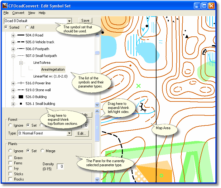
The symbol set is how the OCAD Converter decides what to do with each symbol type of the OCAD map. Since OCAD symbols are customizable, you may need to edit the default symbol set if the symbol numbers on your map don't match the OCAD default.
When the symbols are in 'Sorted' mode, you are most concerned with symbols in the "Unrecognized" category. These symbols are used somewhere within the convert area you selected, but are not defined, so they will be left out.
To define a symbol, right-click on the symbol number and select "Insert". Then select the type of the Symbol Convert Parameter you would like to add. Note that there are different parameter types available for the OCAD point/line/area symbols.
The parameter types are described briefly below. Click for further info:
Control the trees, run speed, and colors of an area. |
|
Dig a hole and fill an area with water for a pond. |
|
Add a building. |
|
Steepen the terrain and add a cliff texture. |
|
Copy another symbol. |
|
Apply a custom texture to the ground map. |
|
Tag these lines as contours for height determination. |
|
Raise or lower the terrain along a line. |
|
Horizontally flatten the terrain along a line, for roads. |
|
Insert a series of 3ds objects along a line. |
|
Converts a line symbol to an area of a certain width. |
|
Prevents the terrain cutter from outlining an area. |
|
Inserts a 3ds object at a point symbol. |
|
Flat terrain area around a point. |
|
Raise or lower the terrain at a point. |
|
Convert a point symbol to an area of certain radius. |
|
Insert a single tree object at a point. |
|
Defines an area that the player can't cross. |