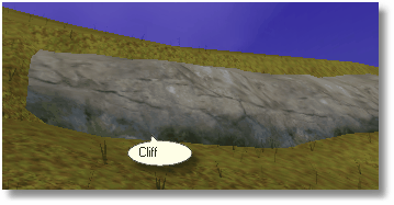
A cliff parameter can be applied to a line symbol and will insert a cliff structure to the terrain.
It will determine the "down" direction of the line, either by using the tags on the symbol, or the slope of the ground.
The ground will be modified to give a steeper drop along the cliff line, by raising the area uphill of the line and lowering the area below.
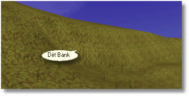
Finally a strip of triangles is created with the specified texture and added along the line with some random variance added to the points. These triangles will be skipped if the "dirt bank" option is selected.
To make a cliff symbol on the map impassable, add a Line To Area parameter to the map symbol and then attach an Uncrossable Area to that area.
OPTIONS
Size
The height range of the cliff structure. To allow the cliffs to naturally form to the terrain, you should supply a range rather than 2 identical values.
Texture
The picture file that should be used to "paint" the cliff surface. This is not used if Dirt Bank is checked.
Dirt Bank (no cliff texture)
Check this to create a steep formation on a hill slope, but without adding any cliff textures.