The OCAD Converter Workflow
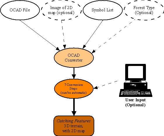
| 1. | The first thing you need to tell the converter is which OCAD file you want to convert. You do this in the Ocad Convert window that displays when the program starts. |
| 2. | The next thing is to select which symbol list you want to use. Optionally, you can also select a specific forest type and/or the 2D JPG map you want to display when running. You do this in the Convert Ocad File window. |
| 3. | After that, the 7 conversion steps proceeds. This can be fully automatic, or you can provide user input during the conversion. |
| 4. | When all the steps are completed, the 3D terrain has been created and is ready to be used in Catching Features. |
Symbol List
The Symbol List (part of the symbol set file) is the most important ingredient to make the OCAD Converter understand how to convert your map.
The Symbol List contains the information about what to do when a certain symbol number is encountered on the map. Some examples of parameters that can be connected with a map symbol number are: insert 3D objects, add trees, color the ground, set vegetation, make an area uncrossable etc. Each symbol can have multiple parameters connected to it.
To avoid unnecessary conversion problems, make sure the OCAD follows the standard numbers of the IOF map norm.
The Symbol List can be modified during step 2 of the conversion process.
A symbol set file also includes a default forest type. This makes perfect sense, since the trees of a forest is for example dependent on ground colors and textures.
Key Features
The key features of the OCAD Converter includes:
| • | Ability to map any OCAD symbol to one or more actions, such as add 3D objects, set the vegetation, set ground color, create forbidden area, and so on. |
| • | Can randomly pick from a list of elements, connected to a OCAD symbol. |
| • | Convert a selected part of the terrain and a selected part of the 2D map. |
| • | Automatic guessing of how the contours on the map go. |
| • | Ground Height Randomness, which can create a somewhat uneven terrain surface, just as in real life. |
| • | Automatically create a 2D map from the OCAD original, if needed. |
| • | Supports manual removal of noise outside the map area, to make the 3D files smaller. |
| • | Default running speeds that tries to match the IOF map norm. |