This step allows user input
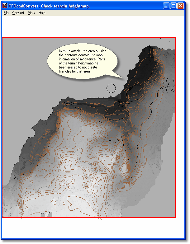
The shaded background represents the heights that the converter has created for your map. If there are any uneven or unused sections around the edges, you can remove them with the mouse and the circular cursor, which will make the resulting 3D map file smaller. In the area you paint with the cursor, no terrain triangles will be created. Don't use the circular cursor in the area where the player will run!
Continue to the next step with Convert/Run Next Step.