This step has NO user input
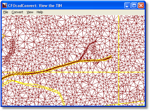
Here you can see the triangle grid that the converter has created for your terrain. Even if this might look odd at first, when you get some experience with OCAD conversion you'll understand more and more of why the triangles located as they are. Zoom in using the scroll wheel if you want to study the ground in more detail.
You can use View/View Contours to see the map on top of the triangles. Please note that this view only displays the triangles for the terrain itself, not the triangles that will be created when objects (boulders, cliffs, houses, etc) are added.
Yellow color represents a border of some kind, such as borders between different vegetation types. Straight yellow vertical or horizontal lines shows where the borders for the map chunks are located.
You can't edit anything at this step, continue to the next with Convert/Run Next Step or step back with Convert/Prev Step.