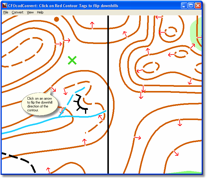
This step allows user input

The converter has tried to guess which side of the contours point downhill. It will use this to create a 3D map of the ground heights.
You can check that it guessed correctly by looking at the red arrows on the contours. They should point downhill. If not, click on them to flip to the other direction.
The black arrows is the arrows that have been altered manually (version 1.313 and later).
If you get black question marks (?) for a contour, it means that the direction of the contour couldn't be guessed and is yet undetermined. Click on the question mark to turn it into a red arrow.
It's a good idea to save the conversion as a CNV file after this step, in case you missed some contour directions the first time.
Generally speaking, joined contours and contours with slope lines are almost always guessed correctly, while contours with loose ends sometimes are guessed incorrectly.
If you have trouble seeing the arrows, try zooming in with the mouse scroll wheel, or selecting View/Contours Only.
Continue to the next conversion step with Convert/Run Next Step.